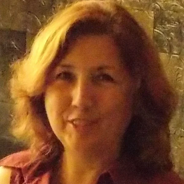
Paula Redweik
Profile
Research Group: RG2 – Ocean, coastal and land surface processes
Position at IDL: Researcher
Job: Assistant Professor
Email: pmredweik@fc.ul.pt
Telephone Number: (351) 21-750-0843
Extension: 528166
Room: 8.1.66
Academic Degree and field of specialization:
PhD – Photogrammetry. Geospatial Engineering
Scientific Informations
ORCID: http://orcid.org/0000-0002-9644-1147
SCOPUS ID: https://www.scopus.com/authid/detail.uri?authorId=42361548400
Researcher ID: https://publons.com/researcher/J-7717-2013/
Research Gate: https://www.researchgate.net/profile/Paula_Redweik
Google Scholar: https://scholar.google.com/citations?user=ziRw9M0AAAAJ&hl=en
Scientific Interests
Main Interests:
Photogrammetry, 3D City Modeling, LiDAR Applications, Terrain Modeling and Monitoring, Heritage Documentation, Solar energy at urban scale
Top 10 Publications:
Redweik, P., Reis, S., Duarte, M. C. (2023) A Digital Botanical Garden: Using interactive 3D models for visitor experience enhancement and collection management. Virtual Archaeology Review, 14(28): In Press, 2023
https://doi.org/10.4995/var.2023.17629
Redweik,P., Sanjosé-Blasco, J., Sanchez-Fernandez, M., Atkinson, A., Martinez-Corrales, L. (2020): Tower of Belém (Lisbon) – Status quo 3D documentation and material origin determination, Sensors 2020; 20(8): 2355. DOI: 10.3390/s20082355;
Redweik,P., Catita, C., Henriques, F., Rodrigues, A.(2019): Solar Glare Vulnerability Analysis of Urban Road Networks—A Methodology, Energies 2019, 12, 4779; doi:10.3390/en12244779
Brito, M.C., Redweik, P., Catita, C., Freitas, S., Santos, M. (2019): 3D Solar Potential in the Urban Environment: A Case Study in Lisbon, 2019 , 12, 3457; doi:10.3390/en12183457
Redweik, P., Teves-Costa, P., Vilas-Boas, I., Santos, T.(2017) 3D City Models as a Visual Support Tool for the Analysis of Buildings Seismic Vulnerability: The Case of Lisbon. International Journal of Disaster Risk Science. 8(3): 308-325. Springer. DOI: 10.1007/s13753-017-0141-x (open access)
M.C. Brito, S. Freitas, , S. Guimarães, C. Catita, P. Redweik (2017) The importance of facades for the solar PV potential of a Mediterranean city using LiDAR data. Renewable Energy, 111: 85-94.
https://doi.org/10.1016/j.renene.2017.03.085
Redweik,P., Garzón,V., Pereira, T. (2016) Recovery of Stereo Aerial Coverage from 1934 and 1938 into the Digital Era. The Photogrammetric Record 31: 9–28 DOI: http://dx.doi.org/10.1111/phor.12137
S. Freitas, C. Catita, P. Redweik, M.C. Brito (2015).Modelling solar potential in the urban environment: State-of-the-art review. Renewable & Sustainable Energy Reviews, Elsevier, Volume 41, January 2015, Pages 915–931. DOI: http://dx.doi.org/10.1016/j.rser.2014.08.060
C. Catita, P. Redweik, J. Pereira, M.C. Brito (2014) Extending solar potential analysis in buildings to vertical facades. Computers & Geosciences, Elsevier, (66) May, 1-12 http://dx.doi.org/10.1016/j.cageo.2014.01.002
P. Redweik, C. Catita, M. Brito, (2013) Solar energy potential on roofs and facades in an urban landscape, Solar Energy, Volume 97, November 2013, Pages 332-341, ISSN 0038-092X, http://dx.doi.org/10.1016/j.solener.2013.08.036
(http://www.sciencedirect.com/science/article/pii/S0038092X13003460)
Marques, F., Matildes, R. and Redweik, P., (2011). Statistically based sea cliff instability hazard assessment of Burgau-Lagos coastal section (Algarve, Portugal). Journal of Coastal Research, SI 64, 927– 931. Szczecin, Poland, ISSN 0749-0208
Projects (10 most relevant):
– Avaliação quantitativa da intensidade da erosão das arribas do litoral do Algarve central (CCDR-Algarve/FCUL) 2006 a 2008
– Criação e Implementação de um sistema de monitorização no litoral abrangido pela área de jurisdição da Administração da Região Hidrográfica do Tejo, I.P. de 2010 a 2013.
– SUSCITY (FCT-MIT Portugal) início 1.1.2015 até 2018. SusCity:Urban data driven models for creative and resourceful urban transitions
– TROANTE (MND) início 12.10.2015 até 2018 (prolongado até 25/07/2020)
– PVcity (FCT) início 1.11.2015(??) até 2018 (prolongado até 30/06/2019)
– HAZARDOUS (FCT) início 1.03.2021
Books & Chapters (up to 10):
F. Marques, R. Matildes, P. Redweik (2013) Statistically Based Sea Cliff Instability Susceptibility Assessment at Regional Scale, at the Burgau-Lagos Coastal Section (Algarve, Portugal) in Landslide Science and Practice
Volume 5: Complex Environment, Editors: Claudio Margottini, Paolo Canuti, Kyoji Sassa, Springer, ISBN: 978-3-642-31426-1 (Print) 978-3-642-31427-8 (Online) pp.147-153 Book chapter
P.Redweik (2012). Photogrammetry. G.Xu (Ed.) Sciences of Geodesy-II , DOI: 10.1007/978-3-642-28000-9_4, Springer-Verlag Berlin Heidelberg (133-183) Book Chapter
Conferences (last 15 presentations):
Redweik, P, Sánchez Fernández, M., Marín, M.J., Sanjosé Blasco J.J. (2023). Um Sistema de Informação de Património baseado em nuvens de pontos aplicado ao Mosteiro dos Jerónimos em Lisboa. X Conferência Nacional de Cartografia e Geodesia - Informação Geoespacial para os Objetivos de Desenvolvimento Sustentável, Instituto Politécnico da Guarda, 02 – 03 Novembro.
Gessner, S., Redweik, P., Reis, S. (2022) Squaring the circles: Digital 3D modelling and website documentation of Lisbon’s earliest slide rule. SIC Symposium Athens, 19 – 23 September, 55-56 (abstract and oral presentation)
Redweik, P., Matildes, R., Marques, F. (2019): Geospatial model for large scale sea cliff rockfall susceptibility mapping, Int. Arch. Photogramm. Remote Sens. Spatial Inf. Sci., XLII-3/W8, 341–347,
https://doi.org/10.5194/isprs-archives-XLII-3-W8-341-2019, 2019
Redweik,P., Duarte, M.C (2018) Solar suitability maps for tropical plants- a decision supporting tool for botanic gardens. 21th Conference on Geo-Information Science – AGILE2018. 12-15 June, Lund, Sweden (poster e abstract)
https://drive.google.com/file/d/1Ul8zWo4ps0A7BBwt1K8VFYMD8iS_3XR3/view
Redweik,P., Sousa, M., Duarte, M.C. (2018) Enhancing botanic and historic information through 3D technologies: the Tropical Botanic Garden in Lisbon. VIII European Congress of Botanic Gardens – Eurogard, 7-11 May, Lisbon (oral presentation)
Redweik,P., Matildes, R., Marques, F. (2017) 3D Geometric Characterization of Moved Masses in Sea Cliffs Using Point Clouds, GI_Forum 2017, Salzburg, Austria, 1, 59 – 68 DOI: 10.1553/giscience2017_01_s59 (open access, Conference Proceedings Citation Index da Web of Science)
Redweik, P., Sanchez-Fernandez, M., Sanjosé, J.J. (2017) Geospatial Study of the Torre de Belém, in Lisbon, allying Laser Scanning and Photogrammetry. Proceedings of the 3rd International Conference on Protection of Historical Constructions PROHITEC 12 – 15 july 2017 . Lisbon, Portugal (paper and extended abstract)
Marques, F., Redweik, P., Vasconcelos, M., Dias, P.(2016) Detection of Landfills in Lisbon, Portugal: a contribution towards 3D geological and geotechnical mapping in recent urban expansion areas. Proceedings of The International Conference of Urban Risks, Lisbon 307-314 ISBN: 978-989-95094-1-2
Redweik, P., Teves-Costa, P., Vilas Boas, I., Santos, T. (2016) Seismic Vulnerability Analysis in 3D City Models (3DCM). . Proceedings of The International Conference of Urban Risks, Lisbon 409-416 ISBN: 978-989-95094-1-2
Freitas,S., Redweik,P., Catita,C., Brito,M.C.(2016). Potencial Solar nas Cidades, Proceedings do VI Congresso Brasileiro de Energia Solar, 4 a 7 Abril , Belo Horizonte, Brasil
Maria Beatriz Carmo, Ana Paula Cláudio, António Ferreira, Ana Paula Afonso, Paula Redweik, Cristina Catita, Miguel Centeno Brito, José Nunes Pedrosa.(2014) Visualization of Solar Radiation Data in Augmented Reality. ISMAR 2014 – Sep 10-12 – Munich, Germany. pp 255-256
Cláudio, A. P., Redweik, P., Carmo, M.B., Lourenço, M., Lopes, P., Matos, A.P, Campos, A., Santos, J., Pedrosa, J., Burgess, R., Blasco, J. J., Sempere, F. (2013). The Teaching Astronomical Observatory of the University of Lisbon (19th century): A Virtual Experience. In Proceedings of the 2013 Digital Heritage International Congress, IEEE, ISBN: 978-1-4799-3169-9, pp 367-370, October, Marseille.
M. C. Brito, P. Redweik, C. Catita (2013) Photovoltaics and zero energy buildings – The role of building facades. Proceedings of the 28th European Photovoltaic Solar Energy Conference, 30 Sept – 4 Oct ,Paris , 3788 – 3790, ISBN:3-936338-33-7
DOI:10.4229/28thEUPVSEC2013-5DO.12.4
Fonte, J., Redweik, P., Gonçalves, J., Lobos, L., Filipe, M. (2012). Recovering Missing Landscapes Through Historical Aerial Images. Proceedings of the 3rd EARSeL Workshop on Remote Sensing for Archaeology and Cultural Heritage Management, Ghent, Belgium, 19st – 22nd September (9 p)
C. Catita, P. Redweik, J. Pererira, (2012). Spatial autocorrelation in the generation of high amplitude DTMs for 3D urban models from LiDAR data. Multidisciplinary Research on Geographical Information in Europe and Beyond, Editors: Jérôme Gensel, Didier Josselin and Danny Vandenbroucke, Proceedings of the AGILE’2012 International Conference on Geographic Information Science, Avignon, April, 24-27, 2012, pp 239-243, ISBN: 978-90-816960-0-5
Awards:
Solar Energy Journal Best Paper Award 2014-2015:
P. Redweik, C. Catita, M. Brito, (2013) Solar energy potential on roofs and facades in an urban landscape, Solar Energy, Volume 97, November 2013, Pages 332-341, ISSN 0038-092X, http://dx.doi.org/10.1016/j.solener.2013.08.036
(http://www.sciencedirect.com/science/article/pii/S0038092X13003460)
2ºprémio do Concurso Internacional de projectos educativos em Fotogrametria com Software PHOTOMOD. Projecto CAMPUS-UL- Elaboration of a map sheet in scale 1:10 000 of the Campus of the University of Lisbon according to the official norms of the Portuguese Authority for Cartography (2012)
Menção Honrosa no 2º Concurso de Ideias para a Sustentabilidade em Ciências (2020) Projeto Ciências Connect

